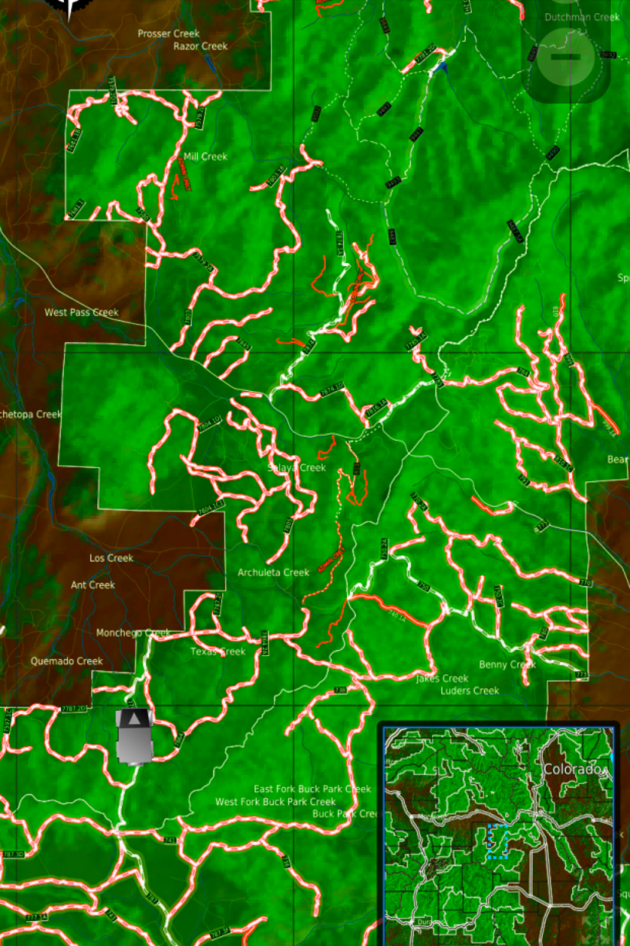
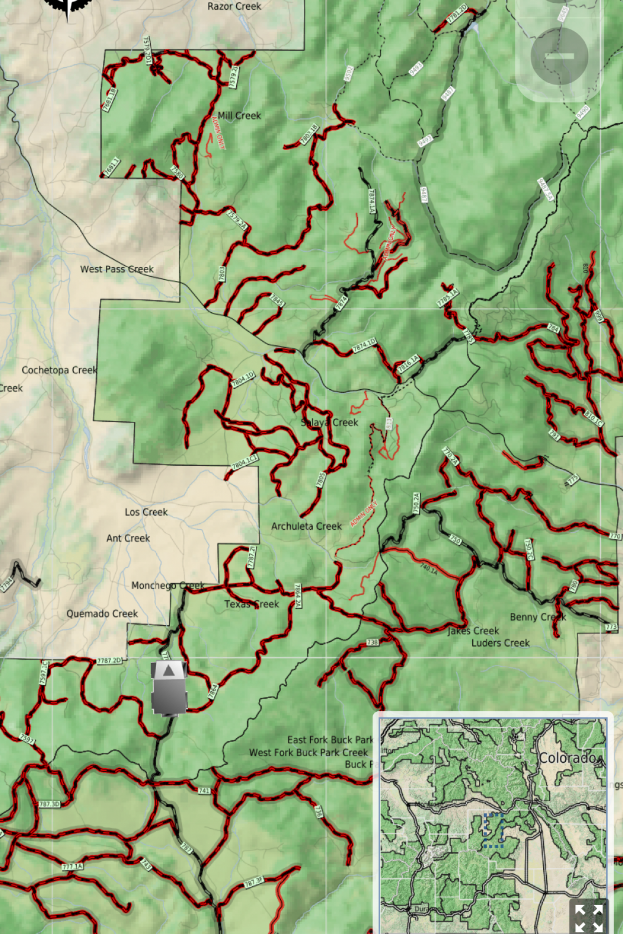
Navigating the National Forest roads and trails can be tricky. OFFROAD ATLAS uses the GPS on your mobile device to show your location on the USDA National Forest Motor Vehicle Use Map (MVUM).
You may browse the map while you have wifi or cell service and OFFROAD ATLAS will automatically download any of the areas you view for offline use when you don't have network access. You may also bulk download any of the areas you plan on visiting.
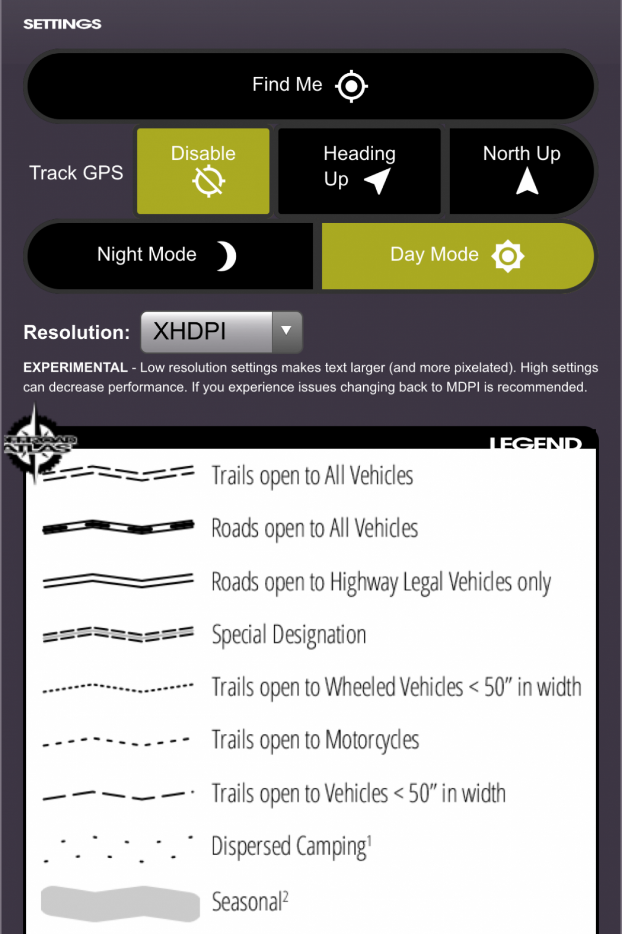
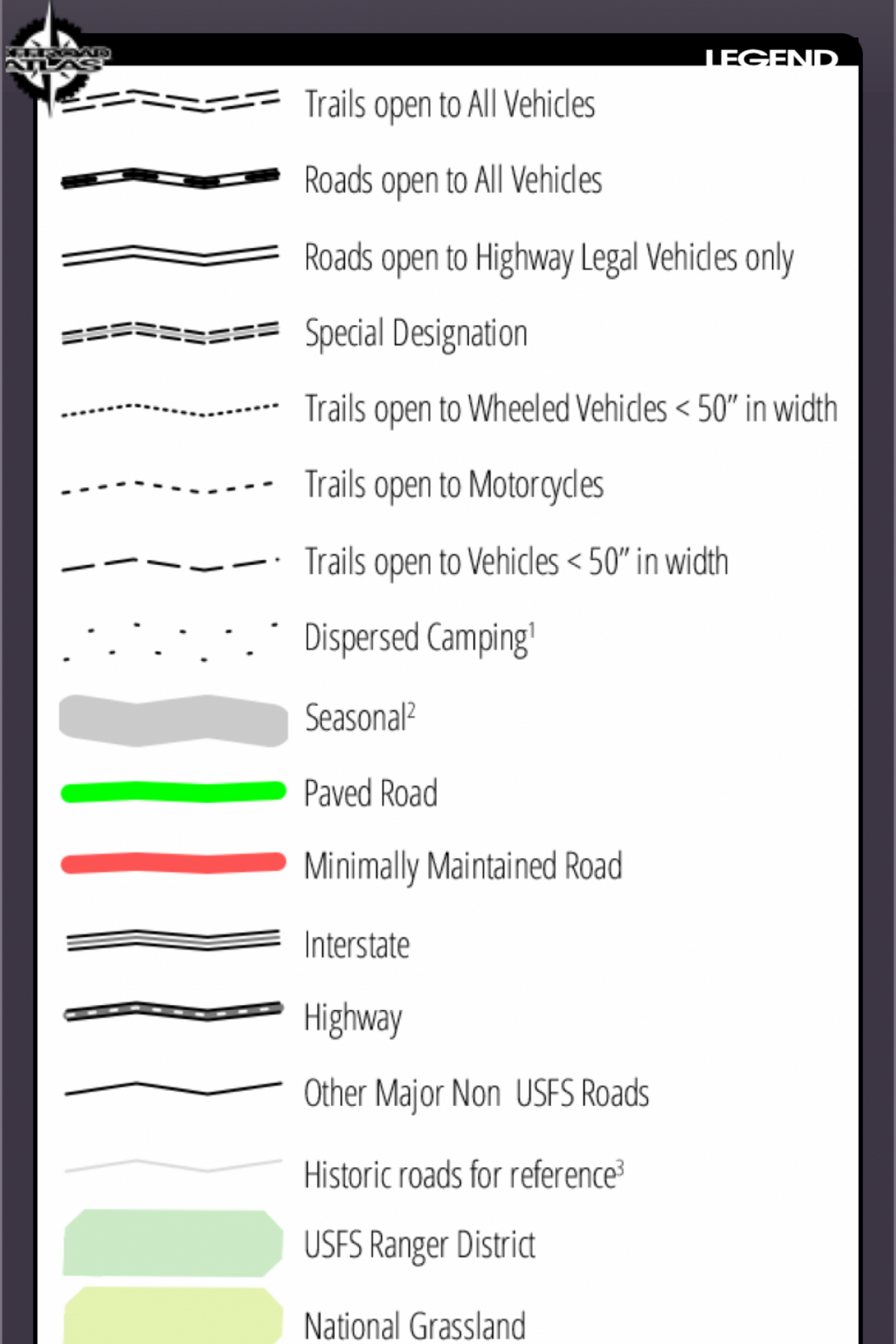
Always have as much information as possible, please consult the published (printable) PDF Motor Vehicle Use Maps available for any individual forests you plan on visiting to get the latest dispersed camping allowances, seasonal closures, and any other relevant information. As always, be careful, many trails and roads are not suitable for passenger car travel. Some are only traversable in the most capable off road vehicles by the most experienced drivers.
Have fun, be safe, and respect the trails.
Have another favorite Android mapping app but want to use the OFFROAD ATLAS Motor Vehicle Use Map? You're in luck!
OFFROAD ATLAS stores its data in the rmaps sqlitedb format that you can use with another mapping app that can handle rmaps data, such as Maverick: GPS Navigation.
-
Browse and download the map for the forests you will be visiting before you head out. Any areas you have downloaded will be available offline.
Browse and download the map for the forests you will be visiting before you head out. Any areas you have downloaded will be available offline. -
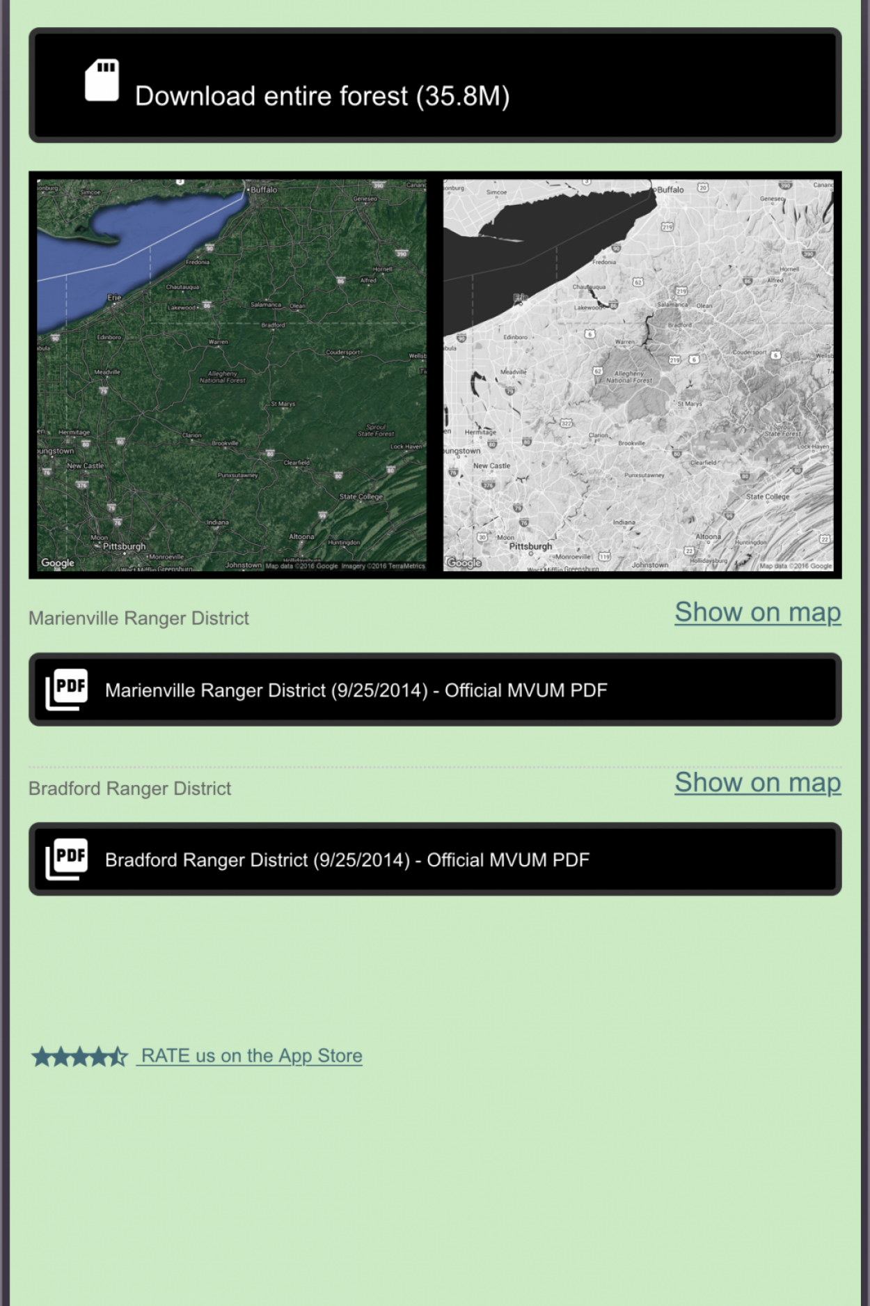
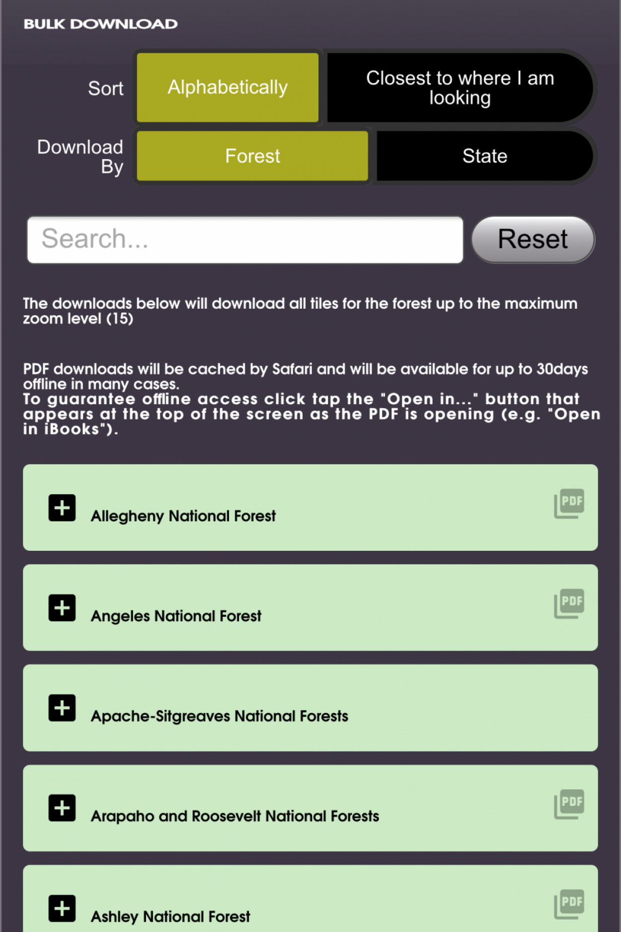
Download the OFFROAD ATLAS map for an entire forest at the click of a button. Links to the official PDF MVUM maps are available for convenience as well.
Download the OFFROAD ATLAS map for an entire forest at the click of a button. Links to the official PDF MVUM maps are available for convenience as well.